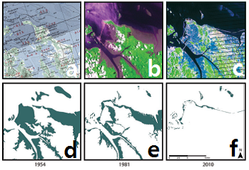
Figure 1 An example of tidal flat mapping results, showing the raw data (a–c) and mapped tidal flats (d–f). The results reveal widespread loss of tidal flats from 1954 (left) to 2010 (right). Satellite images (b) and (c) show that tidal flats present in 1981 (e) were reclaimed for agricultural and industrial land by 2010 (f).
A newly published study assesses the extent of tidal flat loss in the Yellow Sea area. It covers the coastal stretch from north Jiangsu province in China, around to the coast of DPR Korea to Busan in RO Korea. The study analysed old maps and more recent satellite images to assess change over a 50 year period, covering around 4000km of coastline.
Yellow Sea tidal flats provide an estimated $30 billion in ecosystem services. They are important in stabilising coastlines, defending against storm surges, and providing economic opportunities to human communities. The coastal zone is home to 60 billion people. This population pressure coupled with unprecedented urban, industrial and agricultural expansion has put the heath of the ecosystem under severe strain and there is concern for the conservation status of the many species reliant on the tidal flats.
The team digitized the detailed topographic maps of the US Army Map Service dating back to the 1950’s as their baseline, and used the satellite imagery of the Landsat Archive from the 1980’s and early 2000’s, estimating tides at the time of the images and using an error matrix to assess the accuracy. Results show that the extent of tidal flats in the 1980’s was 545,000 ha, that has shrunk to 389,000 ha in three decades, equating to a 28% net loss. The greatest extent of loss is along the coast of China (39.8%) and South Korea (32.2%). Taking into account the 1950’s topographical maps, it is suggested that this could equate to 65% decline in 50 years.
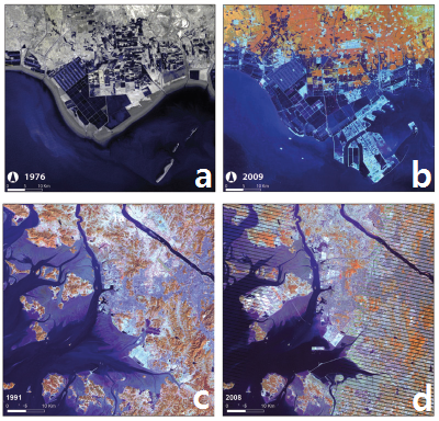
Figure 2 Examples of tidal flat conversion to alternative land uses, Landsat Archive Imagery. (a and b) Coastal reclamation for resource ponds (salt ponds) and industrial land, Bohai Bay, China. (c and d) Reclamation for urban and industrial land, Incheon, South Korea
In discussion, the loss of tidal flats is equated to that of other ecosystems, such as tropical forests and mangroves. It is also highlighted that the drivers for the decline in tidal flats are not unique to the Yellow Sea. Degradation and reclamation is happening worldwide, and seems likely to intensify. It is also mentioned that the damming of rivers, trapping sediment in reservoirs which would otherwise continue to maintain tidal flats and river deltas, combined with resource extraction and coastal development could contribute to sea level rises greater than the global average.
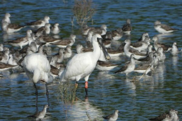
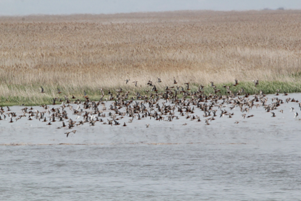
The Yellow sea coastal region is of utmost importance for many migratory shorebird species, which are solely dependent on the food resources supported by the tidal flats for their survival. The Great Knot and Far Eastern Curlew, for example, have been deemed globally threatened by the IUCN.
Nicholas J Murray, Robert S Clemens, Stuart R Phinn, Hugh P Possingham, and Richard A Fuller 2014. Tracking the rapid loss of tidal wetlands in the Yellow Sea. Frontiers in Ecology and the Environment 12: 267–272
Original Link: http://www.esajournals.org/doi/abs/10.1890/130260